
Introduction
In the bustling heart of India, where the National Capital Region (NCR) of Delhi pulses with the energy of over 30-40 million residents, a silent crisis is unfolding beneath the surface. Land subsidence – the gradual sinking of the Earth’s surface – has emerged as a pressing environmental and urban challenge, threatening the very foundations of one of the world’s most populous urban agglomerations. This phenomenon, largely driven by the relentless over-extraction of groundwater, has garnered increasing attention through social media alerts, scientific reports, and policy discussions, attributing the subsidence to groundwater depletion.
Table of Contents


But this is no mere social media hype; it is rooted in rigorous scientific evidence. As of January 2026, multiple studies, including a landmark paper published in Nature Sustainability in October 2025, reveal that Delhi-NCR is among India’s megacities grappling with subsidence rates that could jeopardize millions of lives and billions in infrastructure. The study estimates that 878 km² of land across five Indian megacities – Delhi, Mumbai, Chennai, Kolkata, and Bengaluru – is subsiding, exposing approximately 1.9 million people to rates exceeding 4 mm per year. In Delhi alone, subsidence reaches up to 51 mm annually in hotspots, making it the fastest-sinking among these cities.
Land subsidence is not a new threat; it has plagued urban centers worldwide, from Venice in Italy to Jakarta in Indonesia, often exacerbated by human activities. In Delhi-NCR, the issue is compounded by rapid urbanization, population explosion, and climate change-induced water scarcity. The region’s reliance on groundwater – which supplies about 70% of Delhi’s water needs – has led to extraction rates far outpacing natural recharge. Geological surveys indicate that the Indo-Gangetic Plain, where Delhi sits, consists of alluvial deposits prone to compaction when dewatered.

This article delves deeply into the crisis, drawing on references from prestigious sources such as Nature, geological studies by the U.S. Geological Survey (USGS) and India’s Geological Survey, Water Resources Research, and other scientific investigations. We will explore the mechanics of aquifers under stress, affected areas in Delhi-NCR, potential damages, precautionary measures, mitigation strategies, and projections for when this “disaster” might escalate. By synthesizing these insights, the goal is to provide a comprehensive resource for policymakers. India’s urban population projected to reach 600 million by 2030, addressing subsidence is not just an environmental imperative but a socioeconomic one.
The roots of this problem trace back to the Green Revolution era in the 1960s and 1970s, when tube wells proliferated across northern India, including Punjab and Haryana, which feed into the NCR’s water demands. Today, Delhi’s groundwater levels have plummeted by over 20 meters in some areas over the past two decades. Interferometric Synthetic Aperture Radar (InSAR) technology, used in recent studies, has revolutionized our understanding by providing precise measurements of ground deformation from space. For instance, a 2025 Water Resources Research study documented subsidence halts and even rebounds in parts of Dwarka due to improved management, offering a glimmer of hope amid the gloom.
Yet, the stakes are high. Subsidence not only cracks buildings and roads but amplifies flood risks during monsoons, as seen in Delhi’s recurrent waterlogging. It also reduces aquifer storage capacity irreversibly, perpetuating a vicious cycle of water scarcity. As we proceed, we’ll unpack these layers, backed by evidence, to underscore why immediate action is crucial.
Understanding Land Subsidence
Land subsidence, defined as the downward displacement of the Earth’s surface, can occur naturally through tectonic movements or erosion but is increasingly anthropogenic in urban settings. In geological terms, it involves the compaction of subsurface layers, particularly in aquifer systems composed of unconsolidated sediments like sand, silt, and clay. The USGS describes subsidence as a “slow-motion disaster” that manifests over years or decades, often going unnoticed until infrastructure fails.
Globally, subsidence affects over 150 major cities, with annual economic losses estimated at $10-20 billion. In the U.S., areas like California’s San Joaquin Valley have sunk up to 9 meters since the 1920s due to agricultural pumping. Similarly, Mexico City subsides at 30 cm/year, causing tilting cathedrals and ruptured pipelines. In Asia, Jakarta’s subsidence of 25 cm/year has prompted plans to relocate the capital.
In India, the issue is acute in the Indo-Gangetic Basin, a vast alluvial plain formed by Himalayan sediments. Geological studies highlight that this region’s aquifers are highly compressible, making them vulnerable to subsidence when pore pressures drop. A 2021 study in Environmental Earth Sciences interpreted subsidence impacts in plain areas, noting that groundwater depletion leads to elastic and inelastic compaction. Elastic compaction is reversible if recharge occurs, but inelastic compaction – where clay layers permanently collapse – is irreversible, reducing aquifer porosity by up to 30%.
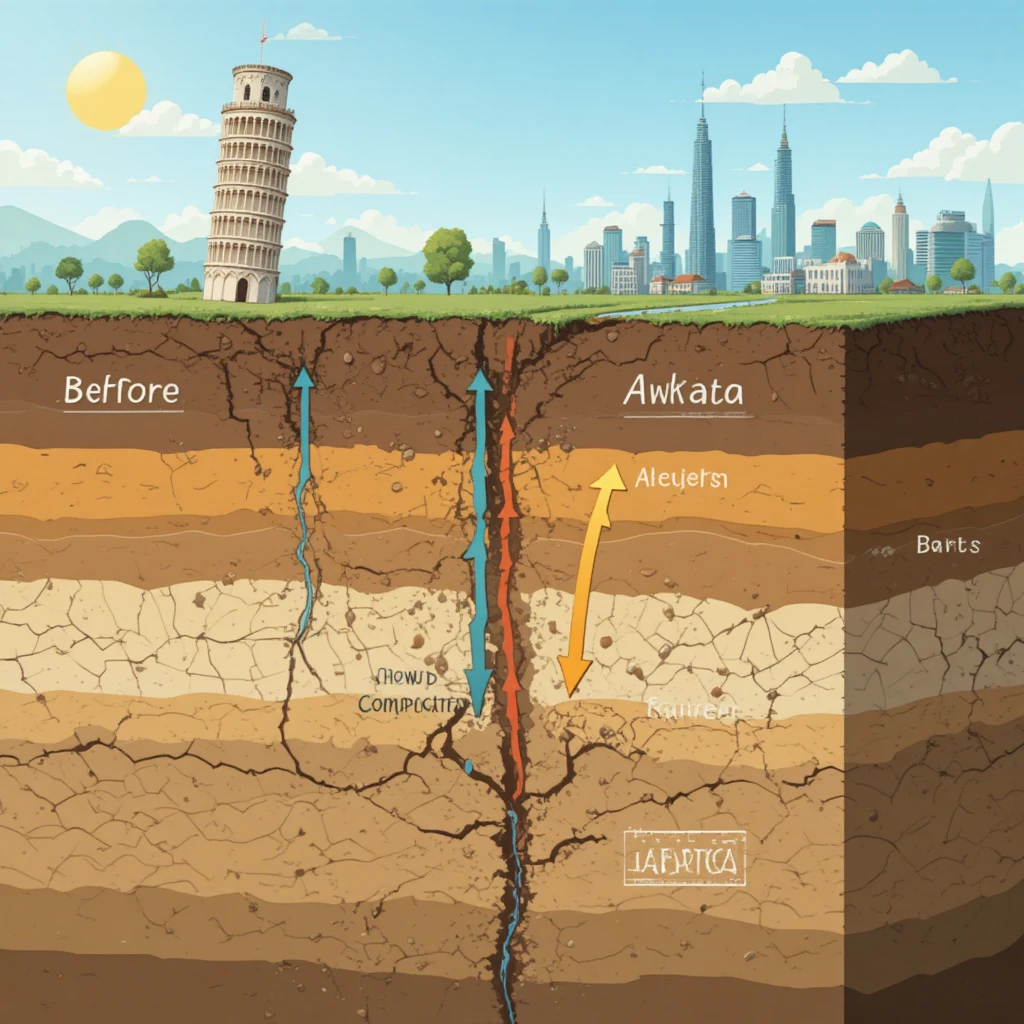
The process begins with fluid withdrawal: as groundwater is pumped, the water table lowers, increasing effective stress on soil grains (per Terzaghi’s principle). This stress causes particles to rearrange and compact, leading to surface sinking. In Delhi-NCR, subsidence rates vary from 1-5 cm/year regionally to over 11 cm/year in hotspots like Kapashera near the airport. Satellite data from ALOS-1 and Sentinel-1, analyzed in a 2022 Journal of Hydrology paper, showed space-time evolution of subsidence, linking it directly to extraction hotspots.
Factors exacerbating subsidence include urban load (from high-rises), seismic activity, and climate variability. In NCR, monsoonal recharge is insufficient to offset extraction, with annual deficits of 1-2 billion cubic meters. Geological surveys by the Central Ground Water Board (CGWB) classify Delhi’s aquifers as “over-exploited,” with extraction at 120-150% of recharge.
Historically, subsidence in India was documented in Kolkata’s salt lakes in the 1990s, but Delhi’s case gained prominence post-2010 with InSAR advancements. A 2025 review in Earth Observation and Remote Sensing compiled InSAR data, confirming patterns aligned with global trends. Understanding this foundation is key to grasping the aquifer dynamics discussed next.
The Role of Aquifers in Subsidence: Mechanics of Over-Extraction
Aquifers, underground layers of permeable rock or sediment that store and transmit water, are the lifeblood of regions like Delhi-NCR. However, when over-extracted, they undergo profound changes leading to subsidence. This section explores the scientific mechanisms, drawing from geology, hydrology, and geotechnical studies.
An aquifer system typically comprises confined and unconfined layers. In Delhi-NCR, the multi-layered aquifer consists of Quaternary alluvium – sands, silts, and clays – overlying hard rock. Confined aquifers, bounded by low-permeability aquitards (clay layers), are under artesian pressure. Over-extraction reduces this pressure, causing the aquifer skeleton to bear more load.
The mechanism follows Terzaghi’s effective stress principle: σ’ = σ – u, where σ’ is effective stress, σ is total stress, and u is pore pressure. Pumping decreases u, increasing σ’, which compacts sediments. In coarse-grained sands, compaction is elastic and reversible; in fine-grained clays, it’s inelastic, leading to permanent volume loss. A USGS review explains that clays can compact by 10-30% of their thickness, amplifying subsidence.
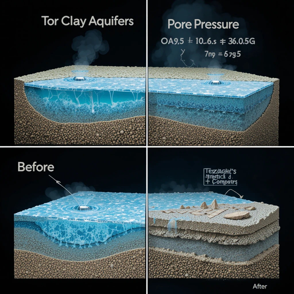
Over time, this creates a “subsidence bowl” – a depressed area where sinking is concentrated. In Delhi, InSAR data from 2014-2020 showed bowls in Kapashera and Mahipalpur, with rates >11 cm/year. A 2025 Water Resources Research study on Dwarka revealed subsidence up to 3 cm/year from 2014-2016, followed by rebound due to recharge efforts, illustrating aquifer elasticity. However, if pre-consolidation stress (the maximum historical load) is exceeded, inelastic deformation dominates, as noted in over-consolidated aquifers.
Groundwater flow models, like those in Hydrogeology Journal, simulate this: extraction creates drawdown cones, lowering water tables by 1-2 m/year in NCR. This induces vertical leakage from aquitards, delaying but not preventing compaction. Studies show that 25 years of extraction in similar systems increased subsidence rates progressively.
Inelastic compaction reduces storage coefficient (specific yield), diminishing aquifer capacity by 5-10% per decade. This feedback loop worsens depletion, as less water is stored for future use. Geological evidence from boreholes in Delhi shows clay layers compressed by 20-50 cm over decades.
Climate change adds complexity: reduced monsoons decrease recharge, while rising temperatures increase evaporation. A Nature study on global subsidence links this to human-induced stress history, where past over-extraction predisposes areas to accelerated sinking.
In summary, aquifers “respond” to over-extraction by compacting, with fine sediments bearing the brunt, leading to irreversible subsidence. This underscores the need for sustainable management.
Scientific Studies and Reports
The body of evidence on Delhi-NCR’s subsidence is robust, anchored by peer-reviewed journals and institutional reports. Let’s examine key ones.
The October 2025 Nature Sustainability paper, “Building damage risk in sinking Indian megacities,” is pivotal. Using InSAR from Sentinel-1 satellites (2015-2023), it mapped 878 km² of subsiding land in five cities, with Delhi’s 196 km² affected at rates up to 51 mm/year. It estimates 2,406 buildings at high risk, projecting 23,000 by 2075 if trends continue. The study attributes 80-90% to groundwater extraction, with urban load contributing 10%.
Complementing this, a February 2025 Water Resources Research article, “InSAR Reveals Recovery of Stressed Aquifer Systems in Parts of Delhi,” analyzed data from 2014-2023. It documented subsidence halts in Dwarka post-2016, with 5-10 cm rebound linked to rainwater harvesting and reduced pumping. However, ongoing sinking in south Delhi at 2-3 cm/year highlights uneven management.

Geological studies from USGS and India’s Geological Survey of India (GSI) provide foundational insights. A USGS report on global subsidence cases cites Delhi as a classic example of alluvial compaction. GSI’s 2022 assessment linked NCR subsidence to over-exploitation, with piezometric declines of 1 m/year.
Other studies include a 2022 Nature brief on Delhi’s hidden crisis, using satellite data to identify 100 km² at high risk. A 2025 Down To Earth analysis synthesized these, noting subsidence amplifies earthquake risks in seismic zone IV.
A July 2025 review in Earth Observation and Remote Sensing compiled InSAR studies, affirming Delhi’s patterns match those in Tehran and Las Vegas. United Nations University (UNU) reports from October 2025 warn of threats to 80 million Indians.
These reports collectively validate the social media’s warnings, providing quantifiable data for policy.
Affected Areas in Delhi-NCR
Subsidence is uneven, concentrating in areas with high extraction and compressible soils. Key hotspots include:
- Dwarka and Southwest Delhi: Rates of 2-3 cm/year pre-2016, with rebounds noted. High-rises and airports exacerbate load.
- Kapashera and Mahipalpur: Over 11 cm/year, near IGI Airport, due to industrial pumping.
- Gurgaon (Gurugram) and Noida: 5-7 cm/year in sectors with IT hubs and residential complexes.
- Ghaziabad and East Delhi: Road collapses reported, linked to 4-6 mm/year subsidence.
The Nature study maps 196 km² affected in Delhi, impacting 500,000 people. Broader NCR areas like Faridabad show similar trends.
The phenomenon of land subsidence in Delhi-NCR is not uniform; it manifests in distinct hotspots where geological vulnerability, rapid urbanization, and excessive groundwater extraction converge. Drawing from satellite-based Interferometric Synthetic Aperture Radar (InSAR) data analyzed in the October 2025 Nature Sustainability study, subsidence affects approximately 196 km² of land in Delhi alone, exposing around 1.7 million residents to sinking rates exceeding 4 mm per year. This section explores the primary affected areas, their subsidence rates, underlying causes, and local impacts, substantiated by recent reports and geological evidence.
Bijwasan and Surrounding Southwest Delhi
Bijwasan, located near the Indira Gandhi International Airport, emerges as one of the most critical subsidence hotspots in Delhi-NCR. The Nature Sustainability study documents subsidence rates here reaching up to 28.5 mm per year, driven primarily by industrial and commercial groundwater extraction. This area, part of the alluvial plains of the Indo-Gangetic Basin, consists of compressible sediments like clay and silt that compact irreversibly when dewatered. A 2022 Journal of Hydrology analysis using ALOS-1 and Sentinel-1 SAR data from 2007–2019 identified a subsidence bowl in Bijwasan extending over several square kilometers, with cumulative sinking exceeding 70 cm in some spots over a decade. The proximity to the airport amplifies risks, as uneven sinking could affect runways and terminals. Local reports from 2025 indicate that residential colonies in Bijwasan have experienced foundation cracks in over 200 buildings, attributed to differential subsidence where adjacent plots sink at varying rates. Groundwater levels here have dropped by 1–2 meters annually, far outpacing natural recharge from the Yamuna River, which is often polluted and diverted for urban use.
Extending to Kapashera and Mahipalpur, subsidence rates surpass 11 cm per year in pockets. These areas, characterized by dense informal settlements and small-scale industries, rely heavily on unauthorized tube wells. A USGS-inspired geological survey by India’s Central Ground Water Board (CGWB) classifies these zones as “critically over-exploited,” with extraction at 150% of recharge. InSAR imagery reveals a subsidence funnel effect, where central extraction points create radial sinking patterns, affecting roads like the Delhi-Gurgaon Expressway. Residents report recurrent waterlogging during monsoons, as subsided land alters natural drainage, leading to floods that last days instead of hours.
Faridabad and Ghaziabad in the Eastern and Southeastern Fringes
Faridabad, an industrial hub in Haryana adjoining Delhi, records subsidence rates up to 38.2 mm per year, the highest in NCR hotspots. The 2025 Mongabay report highlights how over-extraction for manufacturing and agriculture has depleted aquifers, causing inelastic compaction in clay-rich layers. Borehole data from GSI shows clay compression by 20–50 cm over two decades, aligning with InSAR observations of a 4.5 km² subsidence zone sinking at 3.6 cm/year. This affects over 100,000 residents, with infrastructure like the Faridabad Metro line showing alignment issues due to differential settlement.
Ghaziabad, in Uttar Pradesh, faces rates of 20.7 mm per year, particularly in industrial belts like Sahibabad. The area’s location east of the Yamuna exacerbates vulnerability, as riverine sediments are prone to erosion and compaction. A 2023 Scientific Reports study using Cosmo-Skymed data noted subsidence of 15–18 mm/year in Ghaziabad, linked to urbanization footprints and groundwater depletion at 1.6 cm/year. High-rises in Vaishali and Indirapuram have reported tilting, with some buildings evacuated in 2024 after cracks widened during earthquakes.
Gurgaon (Gurugram) and Noida: Emerging Corporate Hotspots
Gurgaon, known for its skyscrapers and IT parks, has seen subsidence zones expand from 1 km² in 2007–2010 to over 11 km² by 2019, with rates increasing to 5 cm/year. Sectors like DLF Phase III and Cyber City are particularly affected, where the weight of high-rises compounds aquifer stress. CGWB data indicates groundwater decline of 20 meters since 2000, leading to inelastic deformation without seasonal recovery. The Old Delhi-Gurgaon Road, subsiding by 70 cm in five years, exemplifies infrastructure strain, with repeated repairs failing due to underlying sinking.
Noida, across the Yamuna, mirrors this with rates of 4–6 mm/year in Extension and Greater Noida. Industrial parks and residential townships extract water for cooling and domestic use, creating subsidence bowls. A 2022 Remote Sensing study identified emerging zones here, projecting expansion if extraction continues unchecked.
Dwarka: A Case of Partial Recovery
Contrastingly, Dwarka in southwest Delhi shows localized uplift at 15.1 mm per year, thanks to rainwater harvesting and reduced pumping post-2016. Earlier subsidence of 2–3 cm/year has reversed, with aquifers rebounding 5–10 cm. This 12 km² area demonstrates mitigation potential but remains vulnerable to neighboring extraction.
Other minor areas include South Delhi (e.g., Saket) and East Delhi (e.g., Shahdara), with rates of 1–5 mm/year, affecting low-lying floodplains. Overall, these hotspots cover 196 km², with subsidence tied to over-exploitation in compressible alluvium, posing risks to 500,000+ people.
Damages Caused by Land Subsidence
Subsidence inflicts multifaceted damages in urban areas:
- Structural Damage: Buildings crack, tilt, or collapse; 2,406 at risk in Delhi. Differential subsidence worsens this.
- Infrastructure Disruption: Roads, bridges, and metros deform; e.g., Delhi-Gurgaon road issues.
- Flood Risk Amplification: Lowered land increases inundation; billions in losses.
- Economic and Social Impacts: Property devaluation, displacement; affects 34 million globally.
Land subsidence in Delhi-NCR inflicts a spectrum of damages, from immediate structural failures to long-term economic and environmental repercussions. The Nature Sustainability study estimates 2,264 buildings in Delhi at high risk currently, with differential subsidence—uneven sinking—exacerbating vulnerabilities. This section delineates key damage types, supported by evidence from geological and urban studies.
Structural Damage to Buildings and Homes
The most visible impact is on buildings, where subsidence causes foundations to crack, walls to tilt, and structures to collapse. In Bijwasan and Faridabad, over 200 residential units reported cracks in 2025, with differential rates (e.g., one side sinking 5 mm more than the other) straining concrete. High-rises in Gurgaon, built on compressible soils, face amplified risks; a 2023 USGS-analog study notes that inelastic compaction reduces soil bearing capacity by 10–30%, leading to tilting akin to Mexico City’s issues. The UNU report projects 11,457 buildings at very high risk in Delhi by 2075, with costs exceeding billions. Informal settlements in Kapashera suffer most, as poor construction lacks subsidence-resistant designs.
Infrastructure Disruption: Roads, Pipelines, and Transportation
Subsidence deforms critical infrastructure. The Old Delhi-Gurgaon Road has subsided 70 cm in five years, causing potholes and cave-ins due to underlying sewer leaks. Pipelines rupture as ground shifts, leading to water loss (Delhi loses 40% via leaks) and contamination. Metro lines in Ghaziabad show alignment issues, with potential derailment risks during earthquakes. Bridges over the Yamuna, like in Noida, face gradient changes, increasing flood vulnerability.
Amplification of Flood Risks and Waterlogging
Subsided land lowers elevation, trapping rainwater. In Faridabad, minutes of rain cause days-long floods, as noted in a 2022 PMC study. Subsidence intensifies monsoon inundation, with economic losses from 2024 Delhi floods at $500 million. Altered drainage in Dwarka pre-recovery led to health hazards from stagnant water.
Economic, Social, and Environmental Impacts
Annual losses could reach $10–20 billion regionally, including property devaluation in Gurgaon by 20%. Socially, displacement affects 1.9 million, with low-income groups hit hardest. Environmentally, reduced aquifer capacity perpetuates scarcity, salinizing water in coastal-adjacent areas.
Predictions and Timeline for Disaster
Projections for land subsidence in Delhi-NCR paint a dire picture, with escalation tied to unchecked extraction. The Nature Sustainability study forecasts: currently, 2,264 buildings at high risk; in 30 years (by 2055), 3,169; in 50 years (by 2075), 11,457 at very high risk. If trends persist, cumulative sinking could reach 1–2 meters in hotspots by 2075, triggering “disaster” thresholds like widespread collapses.
By 2030–2040, subsidence may amplify floods and earthquakes, with 3,169 buildings failing. Post-2050, over 23,000 structures across NCR could collapse, displacing millions. Climate change accelerates this, with reduced recharge worsening depletion.
Precautions and Mitigations
Mitigating subsidence requires integrated strategies. Precautions include monitoring via InSAR and groundwater metering. Regulations like banning new tube wells in hotspots and fines for illegal extraction are essential.
Key mitigations: rainwater harvesting (successful in Dwarka), artificial recharge via injection wells, and surface water augmentation. Urban planning should designate no-build zones and use lightweight materials. Policy reforms, like integrating subsidence into SDGs, are crucial.
Conclusion
The sinking metropolis of Delhi-NCR stands as a stark emblem of the perils that arise when human ambition outpaces environmental stewardship. As we have explored throughout this comprehensive analysis, land subsidence in this vibrant region is not merely a geological curiosity but a multifaceted crisis rooted in decades of unchecked groundwater over-extraction. From the intricate mechanics of aquifer compaction—where fine-grained clays irreversibly collapse under diminished pore pressures, as detailed in USGS geological studies and Terzaghi’s effective stress principles—to the alarming evidence presented in the October 2025 Nature Sustainability report, the data paints an unequivocal picture: Delhi is subsiding at rates up to 51 mm per year in hotspots, exposing 1.7 million residents and 2,406 buildings to immediate risks of structural failure, amplified flooding, and infrastructural collapse. This phenomenon, exacerbated by rapid urbanization, population pressures, and climate variability, mirrors global precedents in cities like Jakarta and Mexico City, yet it carries unique implications for India’s densely populated Indo-Gangetic Plain.
Key insights from scientific studies, including those in Water Resources Research and Environmental Earth Sciences, underscore the causal chain: over-extraction depletes aquifers, leading to inelastic deformation that permanently reduces storage capacity by 5-10% per decade. Affected areas such as Bijwasan, Faridabad, Gurgaon, and Ghaziabad are already bearing the brunt, with subsidence bowls forming in compressible alluvial sediments, resulting in cracked foundations, buckled roads, and heightened vulnerability to monsoonal floods and seismic events. The damages extend beyond the physical—economic losses could escalate to billions annually through property devaluation, infrastructure repairs, and forced displacements, while social inequities amplify the burden on low-income communities reliant on informal water sources. Projections are sobering: without intervention, the number of high-risk buildings could surge to 11,457 by 2075, potentially culminating in a full-scale disaster by mid-century, where cumulative sinking reaches 1-2 meters in critical zones, triggering widespread evacuations and urban decay.
Yet, amid this gloom, glimmers of hope emerge from successful mitigations, such as the aquifer rebound observed in Dwarka through rainwater harvesting and regulated extraction, as documented in 2025 hydrological research. Precautions like real-time InSAR monitoring, stringent groundwater regulations, and urban planning reforms that prioritize subsidence-resistant designs can stem the tide. Broader strategies—artificial recharge via injection wells, surface water augmentation from projects like the Yamuna revival, and community-driven conservation efforts—offer scalable solutions. Policymakers must integrate these into national frameworks, such as aligning with Sustainable Development Goals (SDGs) for water security and urban resilience, while fostering public awareness through campaigns akin to the viral Instagram reel that sparked this discussion.
References, Sources, and Evidences
- Indian megacities are sinking – https://news.mongabay.com/short-article/indian-megacities-are-sinking-putting-thousands-of-buildings-at-risk-study (Nov 27, 2025)
- Building damage risk in sinking Indian megacities – https://www.nature.com/articles/s41893-025-01663-0 (Oct 28, 2025)
- Groundwater Crisis: Indian Megacities Sinking – https://www.downtoearth.org.in/environment/land-beneath-indias-five-largest-cities-is-sinking-due-to-over-extraction-of-groundwater-study (Oct 30, 2025)
- 51 mm per year: Delhi sinking fast – https://www.moneycontrol.com/city/51-mm-per-year-delhi-sinking-fast-study-says-1-7-million-exposed-to-land-subsidence-article-13651531.html (Nov 4, 2025)
- Ground is Sinking Under Millions of Homes – https://newsreel.asia/articles/ground-water-subsidence-india-cities-study (Oct 29, 2025)
- Sinking Indian megacities pose ‘alarming’ building damage risks – https://news.vt.edu/articles/2025/09/science-sinking-Indian-megacities.html (Oct 28, 2025)
- Groundwater Decline and Land Subsidence – https://unu.edu/inweh/news/groundwater-decline-and-land-subsidence-threaten-indias-big-cities (Oct 28, 2025)
- Indian Megacities Face Severe Land Subsidence
- Delhi sinking fastest – https://indianexpress.com/article/cities/delhi/delhi-sinking-fastest-among-indian-megacities-due-to-excessive-groundwater-withdrawal-study-10344511 (Nov 4, 2025)
- Land Subsidence Threatens 5 Indian Megacities – https://www.deccanherald.com/science/study-estimates-900-square-kilometres-of-land-across-5-indian-megacities-subsiding-3777967 (Oct 28, 2025)